
Property boundaries are a fundamental aspect of land ownership, marking the legal perimeters of land parcels. As a property owner, there may be various reasons why you would want to adjust these boundaries. Perhaps you are looking to correct discrepancies, resolve disputes with neighbours or reconfigure your lot for development purposes. This article will serve as a comprehensive guide to understanding boundary adjustment and the processes involved in reshaping your property lines in a lawful and orderly manner.
Why Consider a Boundary Adjustment?
At the crux of any decision to adjust boundaries is the need to reflect the true, intended, or more practical division of land. Discrepancies between actual land use and recorded titles can lead to disputes, potentially complicating sales, transfers, or development. Adjusting the boundaries can provide a clear, undisputed demarcation of property lines that align with present-day usage or plans.
Legal Framework and Compliance
Boundary adjustment is subject to strict legal regulations and must comply with local planning codes and guidelines. Before undertaking any adjustment, it is essential to consult with the relevant local authorities to understand the regulatory framework. This ensures that the adjustment is permissible and does not infringe on zoning laws, easements, or other legal encumbrances that may exist on the property.
Engaging Professional Services
To navigate the legal complexities and technicalities of boundary adjustments, property owners typically need to engage the services of professional surveyors. Surveyors bring expertise in identifying the precise locations of existing boundaries and the technical skill required to draft new boundary plans that comply with legislative requirements.
The Role of Surveyors in Boundary Adjustment
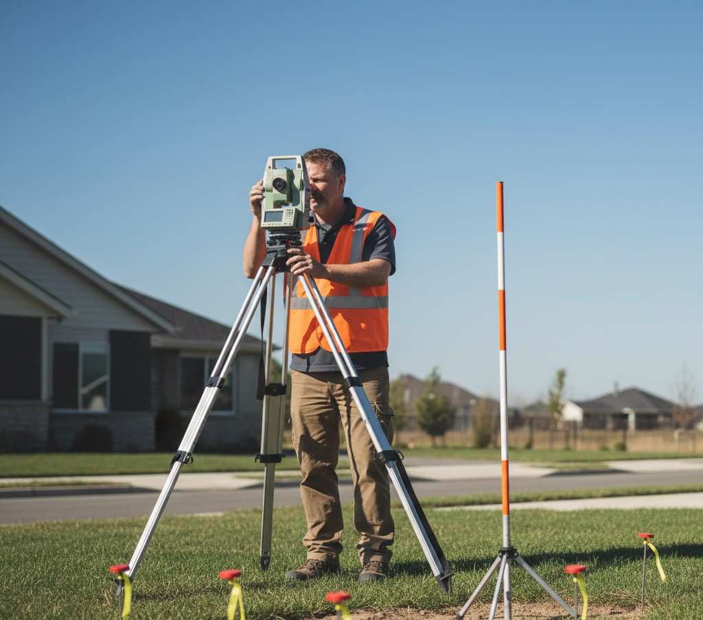
Surveyors play a crucial role in the boundary adjustment process. Their primary responsibility is to conduct a thorough survey of the property which involves identifying both physical and recorded boundaries. This includes consulting historical records, previous surveys, title deeds, and physical indicators on the land itself.
Preparing a Boundary Adjustment Proposal
Following the initial survey, surveyors will prepare a boundary adjustment proposal. This document details the changes to be made and typically includes maps and a description of the new boundaries. The proposal must be precise and adhere to local regulations to be eligible for approval from the planning authorities.
Application and Approval Process
Once a boundary adjustment proposal is ready, the next step involves submitting it to the local planning or land authority. The application process often includes a period for public comment, particularly when the adjustment may affect neighbouring properties. If objections are raised, they need to be addressed before the process can proceed.
Consent from Affected Parties
Boundary adjustments usually require the consent of all affected property owners. This means that if you share a boundary with a neighbour and wish to adjust it, they must agree to the proposed changes. It is important to maintain open communication and foster good relationships with neighbours throughout this process to prevent disputes or legal contention.
Cadastral Documentation and Registration
Following approval, the boundary adjustment must be documented in the cadastral or land registration system. This often involves creating a new survey plan or diagram that reflects the newly adjusted boundaries. The document must be officially lodged with the land registration office to become part of the public record.
The Impact of Boundary Adjustments on Property Value

Altering property lines can have an impact on the value of your land. Depending on the nature of the adjustment and the local property market, reshaping property lines could potentially increase the utility, functionality, and hence, the value of your property. It is beneficial to consider these implications before proceeding with an adjustment.
Long-Term Considerations
When considering a boundary adjustment, it’s important to think long-term. The adjustments you make now will have a lasting impact on the land and may affect future sales, development, and land-use planning. Therefore, it is crucial to ensure that any boundary adjustment aligns with your long-term goals for the property.
Navigating Complexities
While boundary adjustments can seem straightforward, the process often involves navigating complex legalities and practical challenges. From topographical constraints to hidden easements, there are many factors that may complicate the process. This reinforces the importance of engaging knowledgeable professionals who can provide expert guidance.
Conclusion
Boundary adjustments are an important tool for property owners looking to rectify discrepancies, enhance utility, or prepare their land for new initiatives. With the right approach and professional assistance – particularly from experienced surveyors – property owners can navigate the boundary adjustment process efficiently. Remembering the procedures, legal requirements, and the need for clear communications with all parties involved will help in achieving a successful reshaping of property lines that serves your interests and complies with all regulatory stipulations.
By understanding the nuances of boundary adjustment, property owners can ensure their landholdings meet their present and future needs while adhering to pertinent laws and enhancing their overall property value. Accurate, recognised boundaries are indisputably essential to the stewardship of one’s own land and maintaining harmonious neighbourly relations.